Open Source Geospatial: An option for developing nations?
|
SAEON took part in the Free and Open Source Software for Geospatial (FOSS4G) Conference and exhibition which was held in Cape Town in October last year.
FOSS4G is presented annually by the Open Source Geospatial Foundation (OSGeo). The conference gathers developers and users of open source geospatial software from around the world to discuss new directions, exciting implementations, and growing business opportunities in the field of open source geospatial software.
Focused on the practical "make it work, get it done" world of open source application development, this annual conference boasts a very high concentration of geospatial technical opinion leaders. Attendance at this event has grown at over 50% a year since its inception in 2003, paralleling the rapid growth and adoption curve of open source geospatial tools in the marketplace.
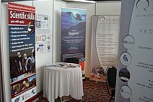
SAEON shared a stand with QSens, CSIR/Meraka and 52 North. The SAEON literature and handouts soon disappeared as the conference participants filtered through the stand.
For SAEON it was particularly gratifying to see that the Geospatial community was embracing GeoNetwork and GeoServer, the very same technologies that the SAEON Egagasini Node has been advised to implement. I attended hands-on laboratory sessions on GeoServer and GeoNetwork and gained valuable information.
The conference programme was divided into 1h30 sessions of four presentations (or one lab) in each session, over a four-day period. The last day was dedicated to workshops. The programme covered a wide range of topics, and all were of interest. Thomas Mtontsi, the SAEON Egagasini Node's Education Outreach Officer, attended an afternoon session on Education Outreach in GIS.
A shortfall of the conference was that there seven parallel presentations/workshops/labs every day, and only one could be attended, making it difficult to prioritise which session to attend. Many interesting sessions were thus missed, and a lot of potential knowledge lost simply due to the programme layout.


