
Building a river geomorphology model to assess catchment management options for western Algoa
|


Geomorphologists* are well placed to provide guidance on a wide range of important environmental change issues.
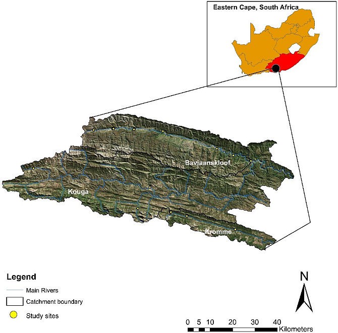
For my MSc degree, I am studying the geomorphology of the Baviaanskloof, Kromme and Kouga catchments in the Eastern Cape as part of a SAEON Fynbos Node project in these catchments under Dr Julia Glenday.
The study contributes to a larger project, supported by the Water Research Commission, undertaken for the western Algoa water management area. The project aims to develop a participatory hydrological model for collective exploration of water resource protection, restoration and water-use management options.
This effort requires an understanding of river channel hydraulics and morphology properties as well as an understanding of historical and current conditions and behaviour and future trajectories of the river. These influence flood risk, erosion and sedimentation along rivers, water quality and ecosystem health.
|
Don’t fight the site – A diverse geomorphology
The Baviaanskloof, Kromme and Kouga catchments are dominated by steep mountains on quartzitic sandstone geology and have trunk streams flowing across valley alluvial deposits. Climatic conditions in the study region are semi-arid. While the tributary mountain streams flow year-round, many of the larger river channels in wide valley reaches are non-perennial (may be seasonally dry). The majority of the wide valley bottoms in the three catchments are fertile and used for agricultural purposes.
My research aims to develop a hierarchical, nested framework model that can explain the spatial variation of river styles in these semi-arid, mountainous catchments. I am looking for evidence of the influence of different drivers on river styles. River style refers to the size and shape of the channel, the material that makes up the river bed and banks, and how these properties do or don’t change over time and the cause of that change.
Drivers that influence these river characteristics range from catchment-scale climate, geology, geomorphology, and land-use, to local riparian area vegetation cover. These insights can be used to predict likely river futures, framed in terms of current river condition of any river reach (Brierley and Fryirs, 2013). The framework will be built by looking at river dynamics, character and behaviour at different scales.
Significant invasive alien plant infestations and agricultural activities in riparian areas, wetlands and mountain slopes have resulted in degradation of natural vegetation such as thicket, fynbos and palmiet (Prionium serratum) wetlands. Flooding, erosion, sedimentation and deteriorating water quality are major issues in the three catchments. While these issues are impacted by land use, they must also be viewed in the context of long-term catchment-scale geomorphic adjustments. For example, some level of river channel erosion and movement would be expected even without human intervention in the landscape.
The rivers in the three catchments are very diverse in terms of their pattern, shape and evolutionary sequences, and thus, catchment scale controls have to be considered for rehabilitation and improved river health management to progress. These considerations need to be site specific.
Use of geographical information systems for rapid assessments
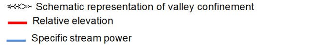
I used GIS analyses to describe the variability of larger-scale drivers of river style over the catchments in order to select my field measurement sites. Firstly, I measured the valley confinement, which describes the degree to which landforms such as hillslopes, terraces and alluvial fans limit the width of the valley floor and floodplain along a river course.
The measurements were done using a GIS-based algorithm with a Digital Elevation Model (DEM) and river lines as an input (Nagel et al., 2014). This provided maps of valley floor width, which varies along the course of each river, with different patterns in the different catchments.
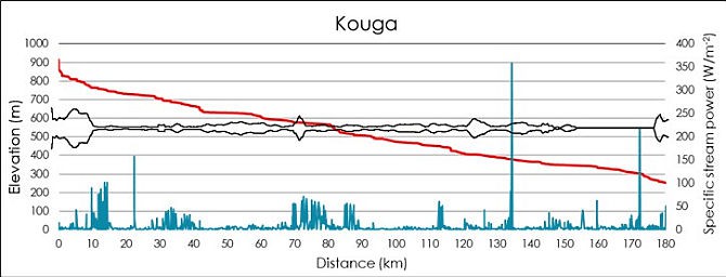
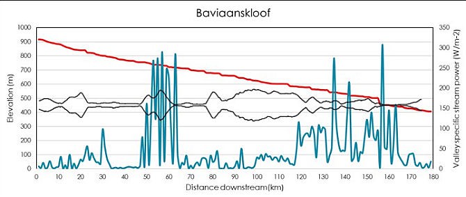
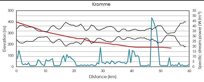
Secondly, a terrain analysis method for calculating and mapping a valley-specific stream power index (SSP) along the river channels was developed. This used rainfall surfaces, contributing catchment area, local slope and valley width.
Stream power is a measure of the energy a river has to move sediment and change its channel form. Using the resulting maps, I could select sample sites that cover the range of valley settings, or catchment-scale driver conditions, mapped for each river. For example, areas with confined (high SSP), partially confined (medium SSP) and unconfined (low SSP) valleys were identified for each catchment.
|
||||
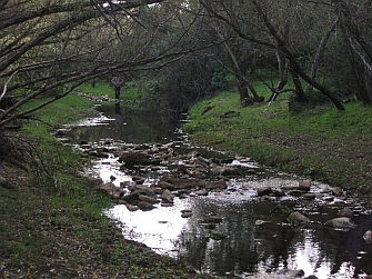
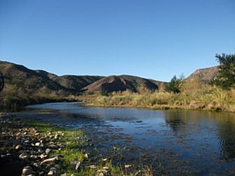
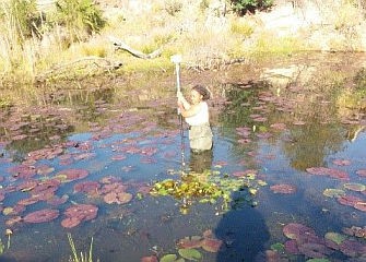
Geomorphic investigation
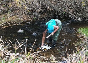
My next step has been to do field measurements at sites representing the different valley settings mapped in the GIS analyses. Topographic surveys were carried out, which included measuring river cross-sections and channel roughness.
I also investigated the sediment regime of the rivers through soil sample collection and pebble counts for the river beds and banks. Site observations included vegetation density, channel pattern and geomorphic features (bars, pools, terraces, etc.). These measurements will be used to understand river-reach form and processes in different valley settings. Going forward, I will look at channel form change over time for selected sites, using historical aerial photography.
|
||||
The results of the GIS analyses and the field measurements will be used to generate a functional classification framework for the river reaches. In this way, I hope to separate the river channels into different reach classes with differing expected shapes and behaviours. I will derive classes and descriptions using statistical modelling with multi-variate methods such as principal component analyses and hierarchical agglomerative classification.
The framework will provide understanding of dominant geomorphic processes that occur throughout these semi-arid, mountainous catchments to produce the river channel shapes and channel changes we see. Knowledge of these processes will aid in building a hydrological model that can assess catchment management options for the western Algoa region, including implications related to flooding and river channel change.
|
Further reading
- Nagel, D. E. et al. (2014) A landscape scale valley confinement algorithm: Delineating unconfined valley bottoms for geomorphic, aquatic, and riparian applications, Gen. Tech. Rep. RMRS-GTR-321. Available at: http://www.treesearch.fs.fed.us/pubs/45825.
- Brierley, G. and Fryirs, K. (2013). Geomorphology and River Management: Applications of the River Styles Framework. 2nd ed. New York: John Wiley & Sons.
* Geomorphology is a science that is focused on understanding interactions on the Earth’s surface, how climate interacts with such surfaces and how human activities have altered or modified these interactions.